
The Waterways of London: Rivers, Canals and Hidden Stories Beneath the Streets
Date post added: 21st January 2026
You may well know the London underground map like the back of your hand. You could be very familiar with London streets and can confidently navigate the city. But to truly know the city, you need to explore another side to it – one shaped by water.
In London, there are mighty rivers, quiet canals and even waterways that no longer see daylight. London’s history, trade and daily life have flowed along its waterways for centuries.
Today, these routes offer some of the capital’s most peaceful walks, surprising views and fascinating stories. We’ll share some of them as we take a wander along London’s waterways, past and present.
What waterway runs through London?
The River Thames
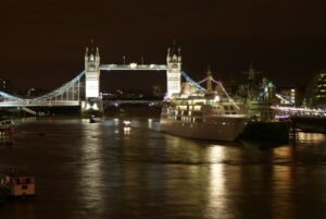
The headline act. The River Thames is London’s defining waterway and its original highway. Long before the London Underground or even the motor car, the Thames was how London moved. For centuries, it was there to carry all manner of goods and people in and out of the city.
Flowing right through Central London, the River Thames passes a remarkable concentration of landmarks. There’s Big Ben and the Houses of Parliament, the London Eye, St Paul’s Cathedral, Tower Bridge and the Tower of London. And so many more…
For centuries, the River Thames was crowded with ships, ferries and working boats. Today, it’s still busy but it’s equally about leisure, sightseeing and commuters.
Walk the Thames with us:
- Our Thames pub walk
- Undiscovered London
- Battersea to Westminster Thames walk
- London Docklands and Limehouse walk
Can you take a boat tour on the River Thames in London?
Yes, you can! It’s one of the most enjoyable ways to see the city.
Seeing London from the river offers a completely different perspective. Buildings feel grander, you notice new aspects and you begin to understand why the Thames was so central to London’s growth.
Choose the river experience you prefer. It could be a sightseeing trip, a river bus, a dining cruise or a high-speed turbo ride. Our choice? A guided sightseeing tour naturally. Explore The River Thames by boat with us. You won’t only see some of London’s most famous landmarks. You’ll also hear about Brunel’s London from our incredibly knowledgeable guide.
The River Lee
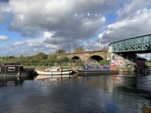
The River Lee (also spelled Lea) has been shaping East London since Saxon times. Running from the River Thames at Limehouse Basin to Hertford, it’s been used for transport, waste disposal, flood control, mill power and pleasure boating. It’s very much a working river.
In more recent history, this area was redeveloped as part of the 2012 Olympics regeneration in East London. That includes the network of Bow Back Rivers which connect to the Lee Navigation, a canal route that runs parallel to the River Lee.
It’s such a great spot for a walk. You’ll experience a fascinating mix of nature, industry and regeneration.
Explore it with us on a special tour from Stratford and on to the River Lee
London’s canals
If the River Thames is London’s main artery, its canals are the quieter backstreets. They’re altogether slower, greener and often surprisingly peaceful. The Canal & River Trust maintains this inland waterway network throughout both England and Wales. That’s 2,000 miles of waterway in all.
London’s canal network developed during the late 18th and early 19th centuries to move heavy goods during the Industrial Revolution. While their commercial role declined, they’ve since become some of the city’s most enjoyable places to walk, cycle, live or simply watch life drift by.
Regent’s Canal
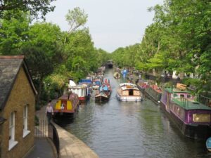
London’s most famous canal, Regent’s Canal runs for around 14km from the elegant Little Venice in West London to Limehouse Basin in East London. Along the way, it passes several of London’s best-loved areas including:
- Little Venice
- King’s Cross
- Islington
- Regent’s Park and London Zoo
- Camden Lock [link to blog]
- Hackney.
The canal path’s a favourite for walkers and cyclists. It’s a wonderful place to find some calm in a busy city. If you’d rather be on the water than beside it. There’s paddleboard and boat hire as well as regular boat trips along the canal.
As you wander the towpath, look out for our favourite waterside sites – the puppet theatre barge, the Word on the Water floating bookshop and the Cascade Floating Art Gallery. The London Canal Museum is a must for anyone wanting to delve deeper into Regent’s Canal history and its people’s stories. You can even step on board a narrowboat to get a feel for that life.
You’ll see some of these highlights on our charming Little Venice canal walk
The Grand Union Canal

The Grand Union Canal’s the longest canal in the UK. It deserves its ‘Grand’ title. It stretches 137 miles, from London all the way to Birmingham. In London, it passes through areas of West London such as Paddington and Brentford.
The word Union reflects the canal’s history. The Grand Union Canal is the result of amalgamations between several independent waterways in the late 19th and early 20th century. It was a crucial link between the capital and the Midlands for transporting goods. Back then, you would have seen barges laden with coal, iron and food all the way along the canal.
Now, the London stretch is far less industrial. That said, some places along the towpath look little changed: the Grand Junction Arms shows the earlier name of the canal. A quaint canal cottage adds character to the view. But mainly, you’ll encounter tree-lined towpaths and moored houseboats. It’s another wonderful example of how industrial infrastructure has been reclaimed for lifestyle activities.
Our Grand Union Canal walk is available upon request. Contact us to make it happen.
The Hertford Union Canal
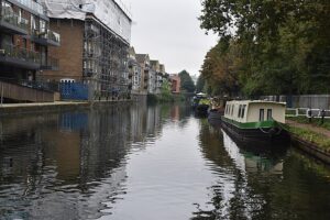
Often overlooked, the Hertford Union Canal is one of London’s hidden gems. At just over a mile long, it links Regent’s Canal to the River Lee. It’s good to remember that size isn’t everything. The Hertford Union Canal played an important role in avoiding tidal sections of the River Thames and speeding up journeys for working boats.
If you’re looking for a peaceful walk, this is the canalside for you. Lined with greenery and wildlife, it’s a tranquil haven to explore at your leisure.
Limehouse Cut

The Limehouse Cut holds a special place in canal history. It’s London’s oldest canal and opened in 1770. Its sole purpose was to provide a direct, safer route between the River Lee and the Thames, avoiding dangerous bends and tidal waters.
This East London waterway is deeply industrial in character. From the 16th century ships were built at Limehouse and traders supplied provisions for voyages. It’s a hugely significant area historically. The banks are steeped in stories of toil, treachery and transformation.
Hear its stories and walk the walk with us on our Limehouse and London Docklands tour
What are the 12 lost rivers of London?
Did you know that there used to be more rivers in London? We’ve carelessly lost some along the way. Today, some of London’s waterways are no longer visible. Many have been buried beneath streets and buildings. They’ve ended up as part of the city’s sewer system. Think of that next time you flush!
The lost rivers of London include Fleet, Tyburn, Westbourne, Walbrook, Effra, Peck, Neckinger, Earl’s Sluice, Falcon, Counters Creek, Stamford Brook and parts of the River Lee.
They may be hidden, but they’re still prevalent. You can trace them through street names, dips in the land and unexpected damp patches underground.
Find out more on our River Tyburn and Little Venice walk, or on our 400 years of the New River walk.
Take a canal walk with us
With 600km of rivers and canals, as well as acres of docks, reservoirs and wetlands across London to explore, you can plan plenty of days out taking in the sights and sounds. London may be famous for its streets, but once you follow the water, you’ll realise its importance.
If you’re curious to go further, guided canal walks are a fantastic way to unlock these stories while seeing parts of London many visitors miss. They’re brought to life by our insightful canal guides who know these waterways inside and out.

David Tucker
David – the Seigneur of this favoured realm – broods over words, breeds enthusiasms and is “unmanageable.”* He’s a balterer, literary historian, university lecturer, journalist, logophile and lifelong thanatophobe. For good measure, he’s the doyen of London guides.

Pippa Jackson
Pippa is a word nerd and content aficionado with a background of working in TV on both sides of the globe. She loves to discover and share the diverse and wonderful stories of her much-loved London. When she’s not writing blogs and articles, you’ll find her walking beside the Thames or even paddleboarding on it (in the finest of conditions only!) or enjoying a coffee in the sunshine with a good book.