
Your Guide to the River Lee Navigation
Date post added: 7th April 2026
So rural yet urban, industrial yet bucolic, natural yet constructed. What’s not to like about the River Lee Navigation?
The Lee Navigation’s a wonderful London waterway to explore. Follow it and you’ll find a constantly changing landscape. Quiet wetlands and grazing meadows give way to old mills, industrial Victorian buildings, Olympic parks and lively East London neighbourhoods. Along this wonderfully varied route, history, wildlife and working waterways coexist.
The River Lea runs from the River Thames all the way north to Hertfordshire. Unlike most London canals, it wasn’t built in a single, grand engineering project. Instead, it evolved gradually over centuries. And unlike purpose-built waterways like the Regent’s Canal, the Lea’s actually a canalised river. That’s a natural waterway which has been improved and reworked to make it easier for boats to navigate.
Today, the Lee Navigation’s one of the capital’s great walking and cycling corridors. We explore why, where and how, right here.
River Lea or Lee Navigation?
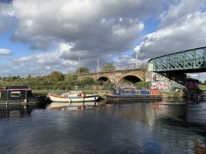
Lee and Lea tend to be used interchangeably. They have been for centuries. But the general rule is that the naturally-formed part of the river is spelled Lea. That also applies to other natural features in the area, like Lower Lea Valley.
But the manmade constructions, like the canalised river, are spelt Lee. You’ll see River Lee, Lee Navigation and Lee Valley Park on Ordnance Survey maps and legal documents, for instance.
What is Lee Navigation?
The Lee Navigation is the canalised section of the River Lea. It was engineered to allow boats to travel between the River Thames and towns north of London.
Rather than digging an entirely new canal, engineers adapted the natural river. They created artificial cuts to bypass winding sections of the River Lea. They built new locks, weirs and aqueducts to control water levels. And they widened channels to accommodate barges and commercial traffic.
Where does the River Lea start and finish?
The River Lea begins in the Chiltern Hills near Luton in Bedfordshire. From there it flows south through Hertfordshire and into Essex, then onto London. On its way, it passes through places such as:
- Ware
- Hertford
- Broxbourne
- Waltham Abbey
- Tottenham
- Hackney Wick
- Stratford
- Walthamstow.
Eventually the river reaches Bow Creek in East London where it joins the River Thames.
The Lee Navigation section of the River Lea runs for roughly 27 miles (43 km), from Hertford to the River Thames. It starts at Hertford Castle Weir, continues to Bow Back Rivers, and then onto Limehouse Cut and out to the River Thames.
That’s not it though. There’s a second branch – the Stort Navigation. That runs from Bishop’s Stortford in Essex to meet the River Lee near Hoddesdon.
Along the way, there are connections with other London waterways, including the Regent’s Canal and the Hertford Union Canal. And it’s this inter-weaving web of waterways that holds endless possibilities for exploration and discovery in London.
A brief history of the River Lee Navigation
Boats were travelling along the River Lea in Roman times. A dugout canoe from the Bronze Age and parts of a Saxon barge have emerged from Walthamstow marshes.
The Vikings are said to have sailed up the river in the early medieval period. For them, it was a convenient route to plunder the unlucky inhabitants of Hertford. And King Alfred once destroyed the Viking fleet near here.
As the river flows through fertile farmland, it was an ideal route for moving grain, timber and agricultural produce into the City of London. But the River Lea’s so much more than a transport route. It’s a river steeped in story.
In 1425, an Act of Parliament authorised improvements to navigation on the river. It was the first such Act to be passed for any river in England. As so often happens, argy-bargy ensued. The barge owners wanted deeper channels and reliable locks so they could move goods efficiently. But the mill owners needed the flow of water to power their mills. They didn’t want it diverted away. Long story short, the boats won.
A series of engineering projects over the centuries tinkered with the natural waterway. Sections of the river were straightened. In the 17th century, the so-called New River was created. That was an attempt to supply clean water from near Ware in Hertfordshire to the citizens of dirty, smelly old London. It was also a precursor to the Lee Navigation.
The river was the source and inspiration for one of the great classics of English literature. Isaac Walton fished along it and wrote “The Complete Angler” in the 17th century.
As industrialisation grew, so did the buildings along the waterway. Mills lined the river, factories appeared along the banks and heavy barge traffic carried goods between the city of London and the countryside.
The factory that produced the famous Lee-Enfield (standard British Army rifle for decades) stood here, and parts of it survive today. Two of its buildings remain in use or are occasionally open to the public. The Bryant & May Match Factory also called this area home. Other sites along the river helped shape modern technology. Nearby facilities contributed equipment for the world’s first high-definition television broadcasts from Alexandra Palace in the 1930s.
The Lee Conservancy Board managed the waterways from the 19th century. But after World War II, it was nationalised. Control of the Lee Navigation passed to the British Transport Commission in 1948. In 1963, that responsibility moved to British Waterways. Now, it’s maintained by the Canal & River Trust.
The Lee Navigation feels peaceful again now. Cattle graze in riverside fields, birds nest in the wetlands and walkers follow quiet towpaths. But the locks and wide channels still hint at the busy barge traffic and the hive of industrial activity of earlier centuries.
What activities can you do along the Lee Navigation?
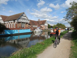
One of the great pleasures of the Lee Navigation is the many ways to enjoy it. But you can probably guess our absolute favourite. You got it: a good walk along the towpath.
Walking
The towpath runs for miles through countryside, parks and city neighbourhoods. It’s a wonderfully varied walking route that’s peaceful in places and lively in others.
Cycling
Its long and relatively flat stretches make the Lee Navigation ideal for cycling. The Lee Valley Park section’s particularly good for bikes.
Boating
Narrowboats, barges and leisure boats still use Lee Navigation, passing through its historic locks and moorings. Canoes and kayaks are increasing in popularity along the river too.
Wildlife watching
Wetlands, reservoirs and marshes along the Lee Valley attract herons, kingfishers, swans and various other species. You’ll also find wildlife habitats around Tottenham Marshes too. They make peaceful retreats despite their proximity to the bustling city.
People watching
There are some great pubs along the waterway. They’re perfect places to pause your walk and take in your surroundings. The Fish and Eels pub in Hoddesdon, and the Anchor and Hope near Hackney Marshes, both serve up hearty fare and chilled drinks to fuel your adventure.
Historic sites
The medieval Rye House Gatehouse near Hoddesdon offers a glimpse into Tudor England. There’s the beautiful Waltham Abbey Church which dates back to the 12th century. Ware’s known for its iconic 18th century riverside gazebos which line the water. And Hertford’s not just a charming market town, but it’s also home to Hertford Castle too.
Interesting canal features on the Lee Navigation
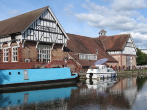
Engineering fans rejoice! There are remarkable feats of engineering functionality to admire along the Lee Navigation. In total, there are about 20 locks on the main navigation between Hertford Lock and Bow Locks. The principal locks are listed here:
Upper Lee
- Hertford Lock
- Ware Lock
- Hardmead Lock
- Stanstead Lock
Broxbourne and Lee Valley
- Feildes Weir Lock
- Dobbs Weir Lock
- Carters Lock
Waltham Abbey and Enfield
- Waltham Town Lock
- Enfield Lock
- Ponders End Lock
- Rammey Marsh Lock
Tottenham and Edmonton
- Stonebridge Lock
- Picketts Lock
- Tottenham Lock
- Horse and Barge Lock
East London
- Old Ford Lock (look out for the lock keepers’ cottages of The Big Breakfast fame)
- Bow Locks
FAQs
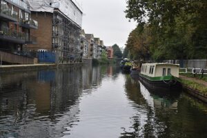
Can you cycle along the Lee Navigation towpath?
Yes. Much of the towpath is suitable for cycling, particularly through the Lee Valley where paths are wider and more rural.
Can you kayak or canoe on the Lee Navigation?
Yes. Kayaking, canoeing and paddleboarding are all popular on sections of the navigation. Some areas require licences or membership through waterways authorities though. It’s best to check before launching into the water.
What’s special about the River Lea?
The River Lea’s unique because it blends ancient river history, industrial heritage and modern city life. Within a single walk you might pass grazing cattle, Victorian locks, Olympic venues, wetlands and historic factories. It manages to combine both rural and urban landscapes at the same time.
Our River Lee walks
If we’ve whet your appetite for waterside walks, you have plenty to choose from. What makes our walks so special? We run them in partnership with the Inland Waterways Association. That means that your canal guide really knows what they’re talking about. They don’t just walk the walk and talk the talk. They’re paid up members of the IWA who’ve spent years along the waterways.
The Secrets of the Northern Queen Elizabeth Olympics Park Walk
From the relatively new Olympic Park and Aquatic Centre in Stratford, to the centuries-old River Lea, you’ll hear incredibly stories and see this area of East London in a new light.
River Lee Navigation: Enfield to Ponders End
Available on request, this special walk shows an area of stark contrasts – old and new, rural and urban, industrial and natural. Chat to us if you’d like to arrange this as a private tour
Queen Elizabeth Olympic Park, Three Mills & Bow Back Rivers
Available as a private tour, this is the walk that came first – exploring the River Lea and its remarkable history long before the Olympics put this corner of London on the map. Get in touch to book.
London canal walks
We offer many walks beside London waterways. You’ll see the sights, hear the stories and gain incredible insights into life on the water.
Join us on an exploration of London’s waterways. Veer off the pavement. Hop off the tube. And discover another version of London as you saunter along its towpaths. From the well-known Regent’s Canal and Grand Union Canal to the lesser-known Lee Navigation, there’s so much to encounter on a canal walk
Take a look at our pick of London’s best canal walks

Pippa Jackson
Pippa is a word nerd and content aficionado with a background of working in TV on both sides of the globe. She loves to discover and share the diverse and wonderful stories of her much-loved London. When she’s not writing blogs and articles, you’ll find her walking beside the Thames or even paddleboarding on it (in the finest of conditions only!) or enjoying a coffee in the sunshine with a good book.

David Tucker
David – the Seigneur of this favoured realm – broods over words, breeds enthusiasms and is “unmanageable.”* He’s a balterer, literary historian, university lecturer, journalist, logophile and lifelong thanatophobe. For good measure, he’s the doyen of London guides.